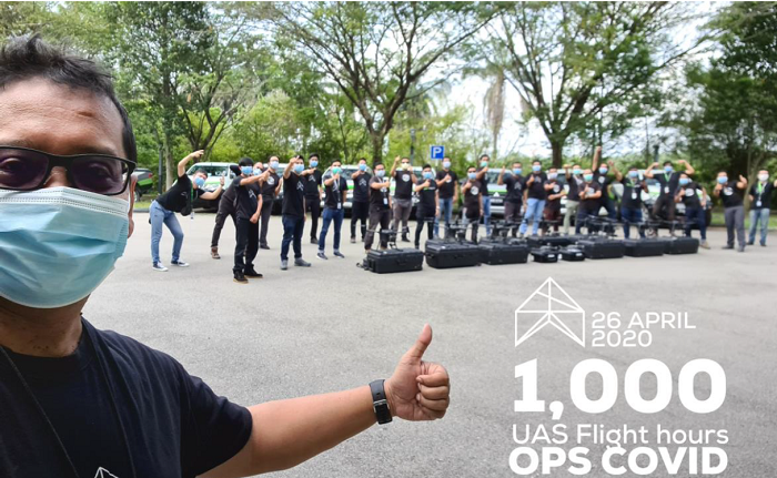
In CSR initiative, Aerodyne completes 1k drone flight hours in Malaysia’s MCO period
By Digital News Asia May 4, 2020
- 23 teams covered 40k km of terrain equal to flying once around earth
- GIS-based data sharing & analytics platform – vertikalitiOps - was used

Exactly one month after Aerodyne started assisting the Malaysian authorities in enforcement of the Movement Control Order (MCO), the team achieved a milestone of completing over 1,000 hours of drone flights time. At an average speed of 40km/hr, the teams have covered over 40,000 kilometres, equivalent to flying around the earth’s circumference.
The Malaysian MCO in place now for over 48 days requires the closure of non-essential private and public organisations, with limited travel to purchase food and essential medical supplies within a 10 kilometre radius.
As a result of strict enforcement, Malaysia has been able to flatten the infection curve and will be easing some restrictions starting 4 May 2020.
Aerodyne Group’s Founder and CEO, Kamarul A Muhamed said, “We are excited by this 1,000 hour milestone and honoured to be part of the authorised team, doing our part in keeping the Malaysian people safe. Drones and data technology have proven to be a powerful and effective tool for battle against Covid-19. And we’re proud of our team whose dedication and performance have been exemplary.”
Aerodyne’s 23 teams of two Aerorangers each volunteered for the project while the company committed US$600,000 (RM2.5 million) worth of drone equipment and provided US$350,000 (RM1.5 million) worth of services on a CSR (Corporate Social Responsibility) basis.
A dedicated, secure GIS-based data sharing and analytics platform – vertikalitiOps - was used to provide realtime video streaming and analytics, increasing the effectiveness of the team through its web and mobile based visual dashboard. The system also overlaid Covid-19 infection locational data to further enhance situational awareness of the spread and drone operation areas.


